


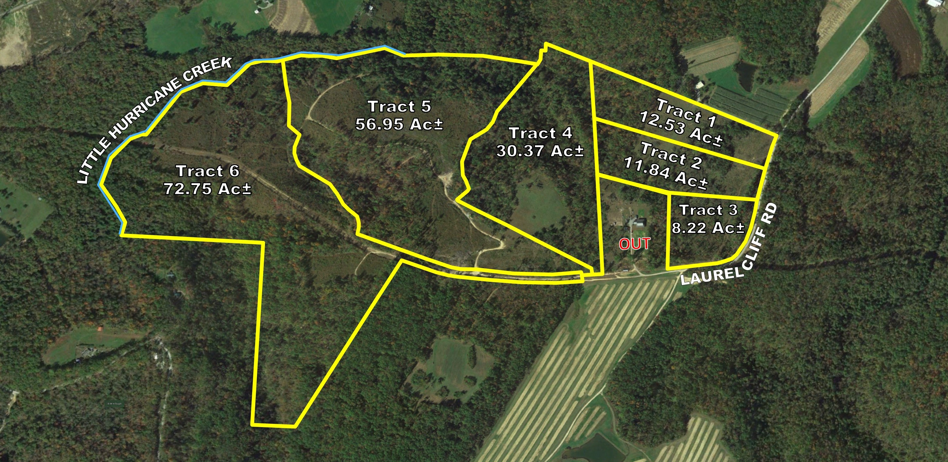
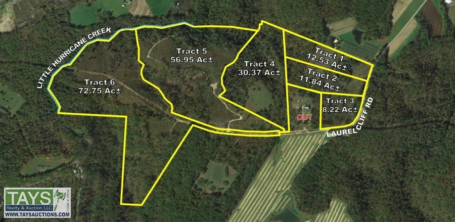
ABSOLUTE ONLINE AUCTION: 192.68 AC± IN 6 TRACTS (6)
All items closed
« Back to list

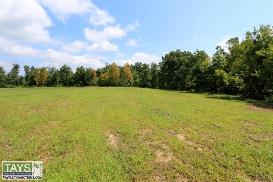
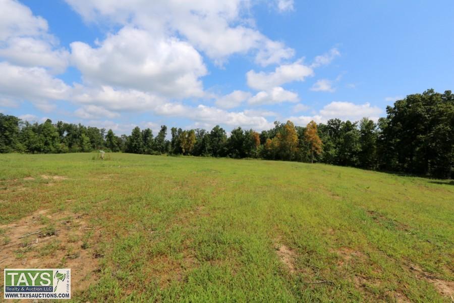
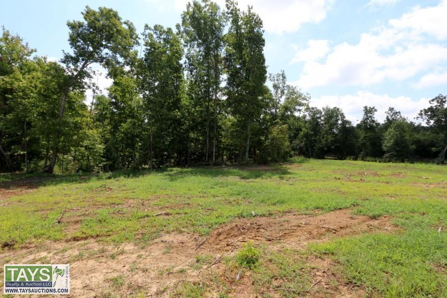
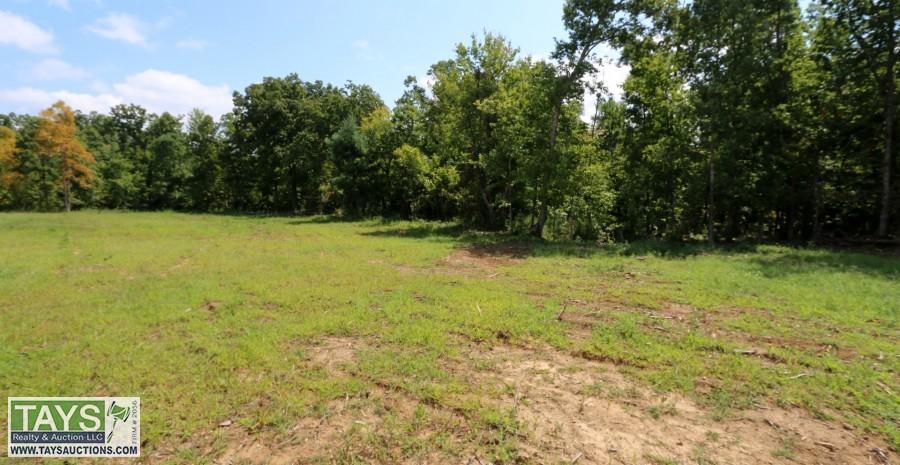
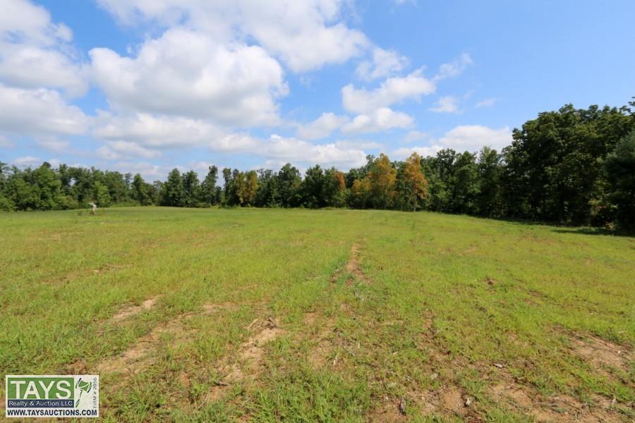
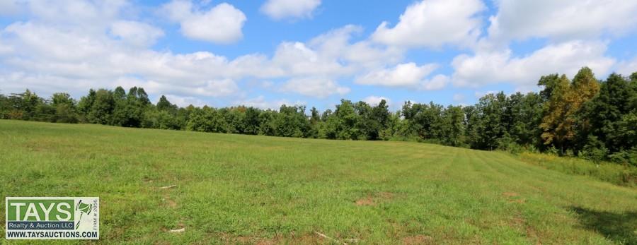
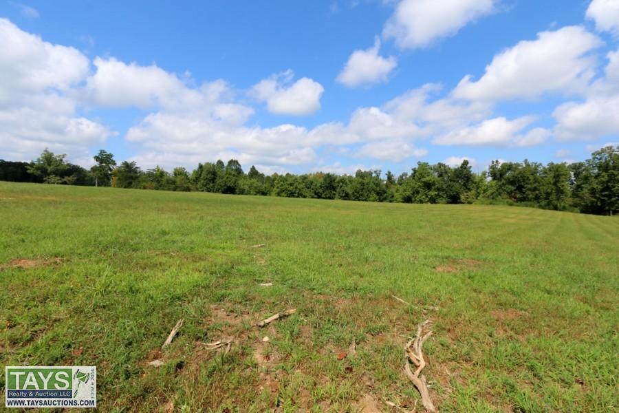
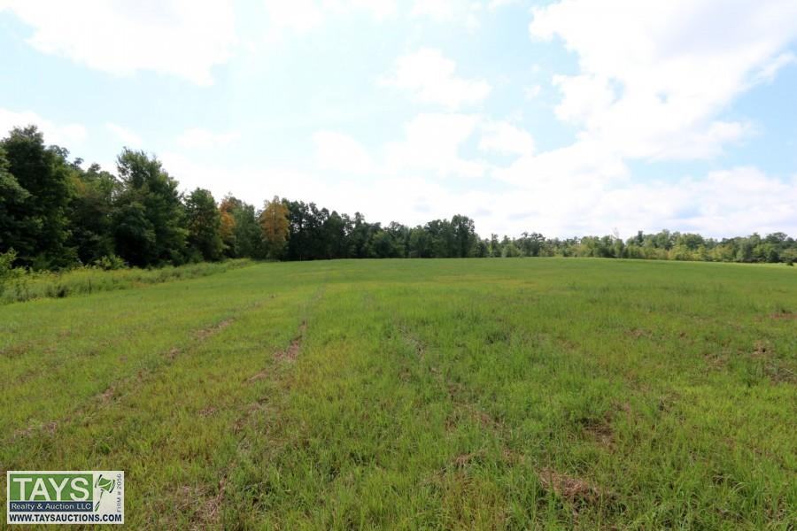
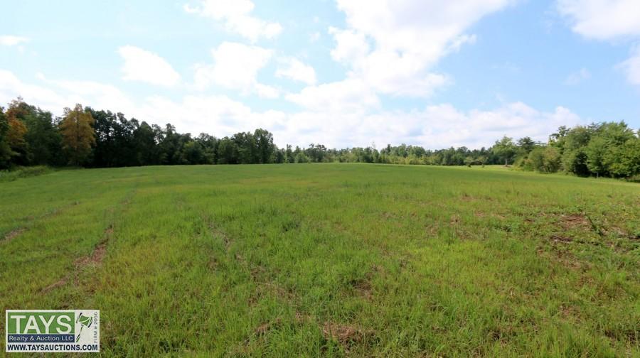
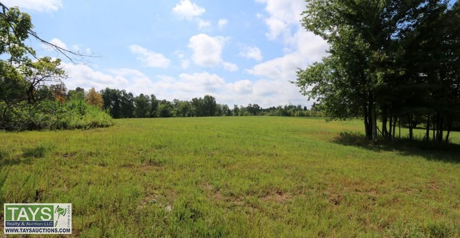
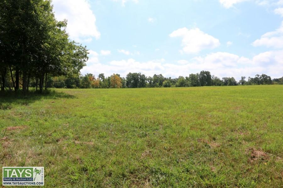
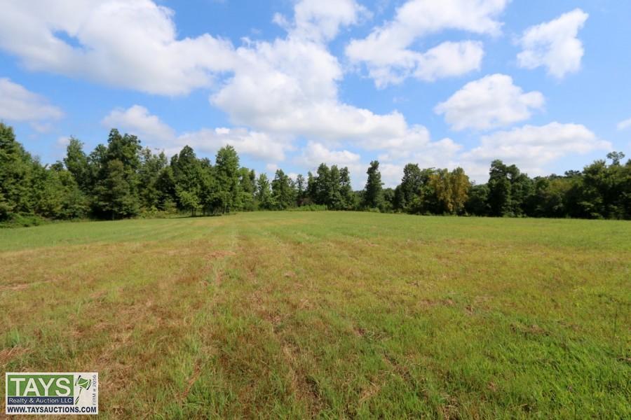
Lot #0004: Tract 4 30.371 Ac±
Sold

Consignor Name: Kevin & Bethany Melton


This page is not working properly on your browser. Please Click Here to switch to basic HTML page or contact us for support.
There was some problem connecting to server. Application is trying to reconnect. Please check your internet connectivity.
Lot #0004: Tract 4 30.371 Ac±
Bidding is not allowed on this item at the moment.
| Current Bid: | ||
|---|---|---|
| NA | ||
| Time Remaining: |
{{item.end_time | durationWords: current_time}}
(bidding was extended)

|
Closed |
| Bidding Ends: | Tue, Oct 8 12:21:03 pm CT | |
| Bidding Ended: | Tue, Oct 8 12:21:03 pm CT | |
| Status: | {{item.bid_status_text}} | |
| High Bidder: | {{crowd_bidder && crowd_bidder == item.high_bidder ? crowd_bidder_username : item.highbidder_username}} | |
|
Bid Increment:
|
||
| Reserve Price: | ||
| Starting Bid: | ||
| Item Location: | ||
| Seller: | {{item.seller_user_name}} | |
| Item has been viewed 2,049 times. | ||
 PREV LOT
 RETURN TO LIST
 ASK ABOUT THIS ITEM
| Low | High | Increment |
|---|---|---|
| $0.00 | $10.00 | $1.00 |
| $10.01 | $25.00 | $2.00 |
| $25.01 | $100.00 | $5.00 |
| $100.01 | $500.00 | $10.00 |
| $500.01 | $1,000.00 | $25.00 |
| $1,000.01 | $10,000.00 | $50.00 |
| $10,000.01 | $100,000,000.00 | $100.00 |
Google Earth: A KML and KMZ file in the documents section that includes the access road and the property boundary. You will need to already have Google Earth or download Google Earth online. Once you have downloaded the file, just click the file and it will open the boundary. Laurel Cliff Rd. KML Laurel Cliff Rd. KMZ
To download Google Earth, go to https://www.google.com/earth/download/gep/agree.html and click agree to download. After clicking agree to download, the file should be downloading and you will click to open the file and follow the steps to setup Google Earth.
Contact Sam Tays at (931) 260-8352 or samtays@taysauctions.com
GENERAL INFORMATION
- Postal Address: Laurel Cliff Rd. Clarkrange, TN 38553
- County: Overton
- Directions: From I-40 take exit 301 toward US-70N W. Turn north onto US-70N W for 0.1 miles. Turn right onto Industrial Dr. for 0.2 miles. Turn left onto Crossville St. for 0.3 miles. Turn right onto TN-62 E/E Commercial Ave. for 7.2 miles. Turn left onto Muddy Pond Rd. for 3.5 miles. Turn right onto Union B for 3.5 miles. Continue onto Shaver Rd. for 0.2 miles. Take a sharp right turn onto Laurel Cliff Rd. for 0.6 miles and continue straight for 0.4 miles and the property will be on your right.
- Buyers Premium: A 10% Buyer's premium will be added to the final bid to determine the contract sales price.
LAND INFORMATION
- County Tax ID: A portion of Overton County Tax Map 130, Group -, Control Map 130, Parcel 022.00.
- Lot Size: 30.371 Acres±. See Survey in 'Auction Documents' section.
- Restrictions: Subject to the Restrictive Covenants of Kevin & Bethany Melton. See Restrictive Covenants in 'Auction Documents' section.
- Easements: Subject to a right-of-way easement for East Tennessee Natural Gas. See Survey in 'Auction Documents' section.
- Encroachments: Any of record see Survey in 'Auction Documents' section.
- Mineral Rights: Unknown. An oil, gas, and mineral title search has not been performed on this property.
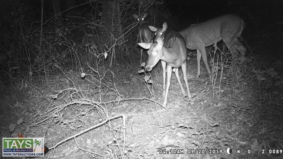
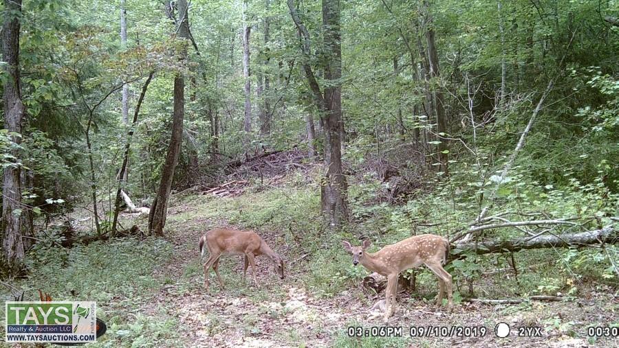
- Features: Tract 4 features a gas well (not in production)
UTILITIES
- Electricity: Service is available with Volunteer Energy Co-Op. Call customer service at 931-879-5853 for more information on applicable set-up & deposit fees.
- Water: Utility district service is currently unavailable.
- Natural Gas: Service is unavailable.
- Sewer: Service is unavailable. New owner will be responsible for installing a subsurface septic system.
TAXES
- If tracts 1-6 sell to the same buyer 2019 Property Taxes will be prorated to date of closing. If tracts 1-6 sell to multiple buyers 2019 taxes will be paid by Seller.
- Back taxes & Greenbelt rollback taxes (if any) will be paid by the Seller.
- 2018 Taxes for whole parcel
- County = $725.63
Consignor Name: Kevin & Bethany Melton
| Bid Date | Bid Amount | Bidder |
| Oct 8, 2019 - 11:34:02 AM | $26,900.00 | i20103 |
| Oct 8, 2019 - 11:24:31 AM | $26,800.00 | i18681 |
| Oct 8, 2019 - 11:13:52 AM | $26,700.00 | i20103 |
| Oct 8, 2019 - 11:13:51 AM | $26,600.00 | i18681 |
| Oct 8, 2019 - 11:13:52 AM | $26,600.00 | i20103 |
| Oct 8, 2019 - 11:13:50 AM | $26,500.00 | i18681 |
| Oct 8, 2019 - 11:13:50 AM | $26,400.00 | i20103 |
| Oct 8, 2019 - 11:13:44 AM | $26,300.00 | i18681 |
| Oct 8, 2019 - 11:13:44 AM | $26,200.00 | i20103 |
| Oct 8, 2019 - 11:13:41 AM | $26,100.00 | i18681 |
| Oct 8, 2019 - 11:13:41 AM | $26,000.00 | i20103 |
| Oct 8, 2019 - 11:13:40 AM | $25,900.00 | i18681 |
| Oct 8, 2019 - 11:13:40 AM | $25,800.00 | i20103 |
| Oct 8, 2019 - 11:13:39 AM | $25,700.00 | i18681 |
| Oct 8, 2019 - 11:13:39 AM | $25,600.00 | i20103 |
| Oct 8, 2019 - 10:31:19 AM | $25,500.00 | i18681 |
| Oct 8, 2019 - 10:31:19 AM | $25,400.00 | i20103 |
| Oct 8, 2019 - 10:31:17 AM | $25,300.00 | i18681 |
| Oct 8, 2019 - 10:31:17 AM | $25,200.00 | i20103 |
| Oct 8, 2019 - 10:31:14 AM | $25,100.00 | i18681 |
| Oct 8, 2019 - 10:31:14 AM | $25,000.00 | i20103 |
| Oct 8, 2019 - 10:30:46 AM | $24,900.00 | i18681 |
| Oct 8, 2019 - 10:30:46 AM | $24,800.00 | i20103 |
| Oct 8, 2019 - 10:15:00 AM | $24,700.00 | i18681 |
| Oct 8, 2019 - 10:15:00 AM | $24,600.00 | i20103 |
| Oct 8, 2019 - 10:13:58 AM | $24,500.00 | i18681 |
| Oct 8, 2019 - 10:13:58 AM | $24,400.00 | i20103 |
| Oct 8, 2019 - 10:13:56 AM | $24,300.00 | i18681 |
| Oct 8, 2019 - 10:13:56 AM | $24,200.00 | i20103 |
| Oct 8, 2019 - 10:13:53 AM | $24,100.00 | i18681 |
| Oct 8, 2019 - 10:13:53 AM | $24,000.00 | i20103 |
| Oct 8, 2019 - 10:13:52 AM | $23,900.00 | i18681 |
| Oct 8, 2019 - 10:13:52 AM | $23,800.00 | i20103 |
| Oct 8, 2019 - 10:13:50 AM | $23,700.00 | i18681 |
| Oct 8, 2019 - 10:13:50 AM | $23,600.00 | i20103 |
| Oct 8, 2019 - 10:10:51 AM | $23,500.00 | i18681 |
| Oct 8, 2019 - 10:10:51 AM | $23,400.00 | i20103 |
| Oct 8, 2019 - 10:04:46 AM | $23,300.00 | i18681 |
| Oct 8, 2019 - 10:04:46 AM | $23,200.00 | i20103 |
| Oct 6, 2019 - 7:19:03 AM | $23,100.00 | i18681 |
| Oct 6, 2019 - 7:19:03 AM | $23,000.00 | i10549 |
| Oct 6, 2019 - 7:18:36 AM | $20,300.00 | i10549 |
| Oct 6, 2019 - 7:18:36 AM | $20,200.00 | i18681 |
| Oct 3, 2019 - 4:03:51 AM | $20,100.00 | i10549 |
| Oct 3, 2019 - 4:03:51 AM | $20,000.00 | i18942 |
| Oct 1, 2019 - 1:35:04 PM | $17,300.00 | i18942 |
| Oct 1, 2019 - 1:35:04 PM | $17,200.00 | i18681 |
| Sep 28, 2019 - 6:54:59 AM | $17,100.00 | i18942 |
| Sep 28, 2019 - 6:54:59 AM | $17,000.00 | i7475 |
| Sep 20, 2019 - 10:19:01 AM | $16,100.00 | i7475 |
| Sep 20, 2019 - 10:18:50 AM | $16,000.00 | i7736 |
| Sep 20, 2019 - 10:18:51 AM | $16,000.00 | i7475 |
| Sep 19, 2019 - 2:38:44 PM | $15,100.00 | i7736 |
| Sep 19, 2019 - 2:38:44 PM | $15,000.00 | i7475 |
| Sep 19, 2019 - 2:36:56 PM | $12,600.00 | i7475 |
| Sep 19, 2019 - 2:36:56 PM | $12,500.00 | i7736 |
| Sep 19, 2019 - 2:33:05 PM | $10,050.00 | i7736 |
| Sep 19, 2019 - 2:32:43 PM | $10,000.00 | i7475 |
| Sep 19, 2019 - 2:32:44 PM | $10,000.00 | i7736 |
| Sep 19, 2019 - 2:32:34 PM | $6,650.00 | i7475 |
| Sep 19, 2019 - 2:32:34 PM | $6,600.00 | i7736 |
| Sep 19, 2019 - 2:31:50 PM | $6,550.00 | i7475 |
| Sep 19, 2019 - 2:31:50 PM | $6,500.00 | i7736 |
| Sep 19, 2019 - 2:31:10 PM | $5,150.00 | i7475 |
| Sep 19, 2019 - 2:31:10 PM | $5,100.00 | i7736 |
| Sep 19, 2019 - 2:31:05 PM | $5,050.00 | i7475 |
| Sep 19, 2019 - 2:31:05 PM | $5,000.00 | i7736 |
| Sep 19, 2019 - 2:31:01 PM | $4,950.00 | i7475 |
| Sep 19, 2019 - 2:31:01 PM | $4,900.00 | i7736 |
| Sep 19, 2019 - 2:30:45 PM | $4,850.00 | i7475 |
| Sep 19, 2019 - 2:30:45 PM | $4,800.00 | i7736 |
| Sep 19, 2019 - 8:27:55 AM | $4,250.00 | i7475 |
| Sep 19, 2019 - 8:27:55 AM | $4,200.00 | i16958 |
| Sep 19, 2019 - 8:27:35 AM | $4,150.00 | i16958 |
| Sep 19, 2019 - 8:27:35 AM | $4,100.00 | i7475 |
| Sep 16, 2019 - 8:45:44 PM | $4,050.00 | i16958 |
| Sep 16, 2019 - 8:43:23 PM | $4,000.00 | i20031 |
| Sep 16, 2019 - 8:43:24 PM | $4,000.00 | i16958 |
| Sep 16, 2019 - 8:43:10 PM | $3,550.00 | i20031 |
| Sep 16, 2019 - 8:43:10 PM | $3,500.00 | i16958 |
| Sep 16, 2019 - 8:42:30 PM | $3,050.00 | i20031 |
| Sep 16, 2019 - 8:42:30 PM | $3,000.00 | i16958 |
| Sep 16, 2019 - 8:42:13 PM | $2,550.00 | i20031 |
| Sep 16, 2019 - 8:42:13 PM | $2,500.00 | i16958 |
| Sep 16, 2019 - 12:14:51 PM | $2,250.00 | i20031 |
| Sep 16, 2019 - 12:14:51 PM | $2,200.00 | i8698 |
| Sep 12, 2019 - 9:07:51 AM | $2,050.00 | i8698 |
| Sep 12, 2019 - 9:07:51 AM | $2,000.00 | i20031 |
| Sep 11, 2019 - 9:05:16 PM | $1,025.00 | i20031 |
| Sep 11, 2019 - 9:03:54 PM | $1,000.00 | i8698 |
| Sep 11, 2019 - 9:03:55 PM | $1,000.00 | i20031 |
| Sep 11, 2019 - 4:03:48 PM | $2.00 | i8698 |
| Sep 10, 2019 - 7:50:26 PM | $1.00 | i17379 |
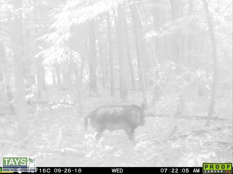
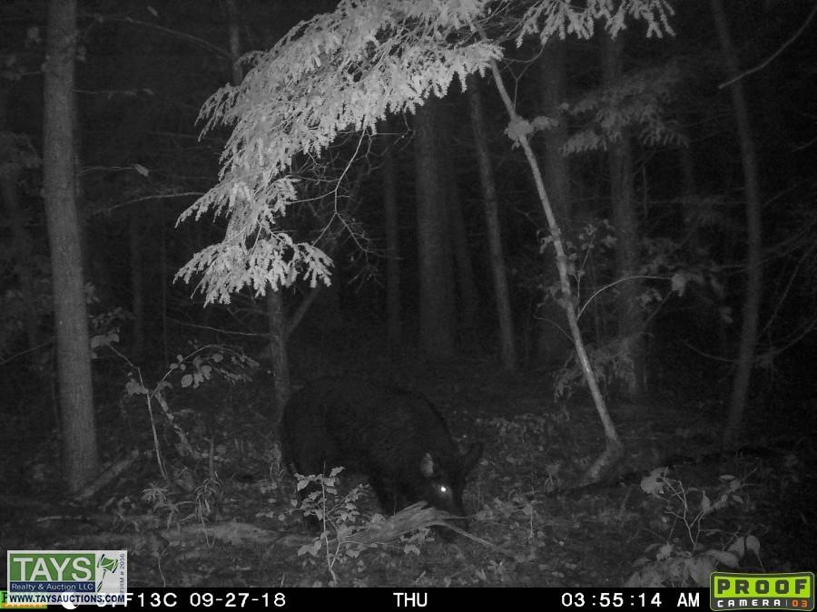
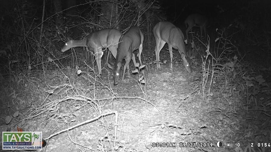
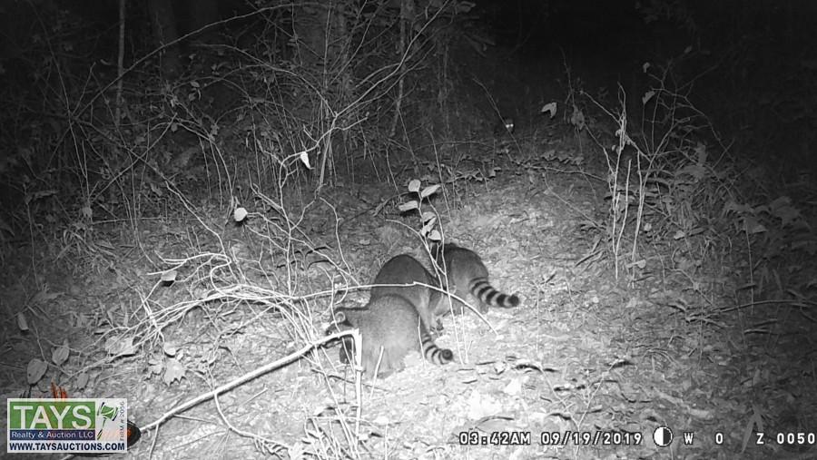
Click on any picture to see a larger image.
 Page last refreshed Thu, Apr 25, 10:38pm CT.